Montreal’s underground city (officially RÉSO or La Ville Souterraine in French) is an underground, interconnected network of shops, malls, offices, hotels, museums and entertainment venues. It is the largest underground complex in the world. In total, it covers 12 square kilometers (4.6 sq mi) of space, with more than 33 kilometers (20.5 miles) of tunnels to explore. It can be accessed throughout downtown Montreal via seven metro stations, and there are also approximately 120 entrances at street level.
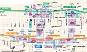
To help you find your way around the underground city, Montreal’s tourism board and public transportation authority have various maps of Montreal’s Underground City. The map below is the most comprehensive map of the Underground City. It covers all Metro stations that connect to the Underground city along with their Metro line and schedule. Additionally, it highlights all sections of the Underground City in Blue. Major attractions and important landmarks such as the Quartier des Spectacles and Bell Centre are also highlighted on the map. Click on the image below to download a PDF version of the RÉSO map. The map is provided by the STM.
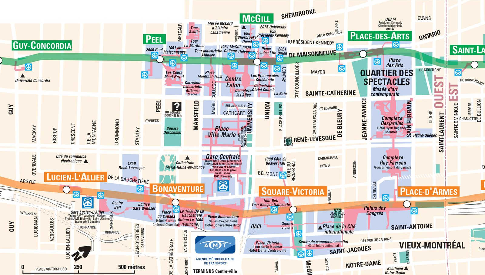 Download the PDF Map of Montreal’s Underground City
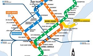


Kassie
May 3, 2017 at 11:28 am
None of the maps help. I got lost down there as there are no signs in the tunnels to direct you or a map in the tunnels to say where you are. Toronto tunnels are easy to navigate as a tourist they have a map down there with a little more help.
I even tried to use gps and that didn’t help. I had to come up to street level as there were too many exits and passages.
Pingback: La ciudad subterránea de Montreal – Chiqui The Traveller
Pingback: La ciudad subterránea de Montreal – CHIQUI THE TRAVELLER
Pingback: La ciudad subterránea de Montreal - CHIQUI THE TRAVELLER
Pingback: MONTREAL: UN VIAGGIO IDEALE - MiMom Mag
vtvagabond
September 15, 2022 at 12:29 pm
lousy map foruseon smart phone
Pingback: Gear up! It’s going to be a snowy winter - The McGill Tribune
Pingback: [旅行] 加拿大 蒙特利爾 地下城| Montreal Underground City
Pingback: Cool Walkability Planning - melk360
Pingback: Cool Walkability Planning – Carisplan
Pingback: - Easy Seniors Travel
Pingback: 9 Exciting Things to Do in Montreal on a Rainy Day
Sam
February 24, 2024 at 11:08 am
A 5km walk max from end to end. Not much to see here, just nice for us living here in the winter when it’s -20c outside so we can get to where we want without freezing.
Pingback: Must see spots when travelling to Montreal with Kids